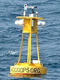
|
There are no recent reports for this station. |
|
|
|
A marine forecast is not available for this station. |
A detailed observation summary is not available for this station. |
A detailed wave summary is not available for this station. |
41024 | 33.85N | 78.48W | Sunset Nearshore (SUN 2) |
SNSN7 | 33.87N | 78.51W | 8659897 - Sunset Beach, NC |
OCPN7 | 33.91N | 78.15W | OCP1 - Ocean Crest Pier, NC |
MROS1 | 33.66N | 78.92W | 8661070 - Springmaid Pier, SC |
SMBS1 | 33.66N | 78.92W | Springmaid pier, SC |
NOQN7 | 34.16N | 77.85W | Research Creek, North Carolina Reserve, NC |
NOXN7 | 34.16N | 77.85W | North Carolina Reserve, NC |
41027 | 33.30N | 78.14W | Sunset Mid-Shelf (SUN 3) |
JMPN7 | 34.21N | 77.80W | 8658163 - Johnny Mercer Pier, Wrightsville Beach, NC |
41038 | 34.14N | 77.71W | ILM2 - 5 miles SE of Wrightsville Beach, NC |
41013 | 33.44N | 77.74W | Frying Pan Shoals, NC Buoy |
NIWS1 | 33.35N | 79.19W | North Inlet-Winyah Bay Reserve, SC |
NIQS1 | 33.35N | 79.19W | Oyster Landing, North Inlet-Winyah Bay Reserve, SC |
FPSN7 | 33.49N | 77.59W | Frying Pan Shoals, NC |
41037 | 33.99N | 77.36W | ILM3 - 27 miles SE of Wrightsville Beach, NC |
Data provided by National Data Buoy Center
|